
If I’m going to be honest, you can just skip this hike. It’s not very enjoyable and the payoff just isn’t there and there are lots of other better hikes in Death Valley in my opinion.
Overview:
- Distance: 1 mi (but feels like more)
- Type: Out & Back
- Time: 1-2hrs
- Elevation at trailhead: 400 feet
- Elevation Gain/Loss: 86ft
- Difficulty: Easy
- Crowd Factor: High
- Best Time: Feb-April or October-November
- Permits/Fees: Death Valley Entry Fee: $35
- Water: No
Directions to the Trail Head
From Stovepipes Wells or Furnace Creek, continue south on 190.
The entrance to the trailhead will be clearly marked on the left side of the road. From Stovepipe Wells it’s about 45mins, and about 25 from Furnace Creek.
The road is a dirt road, though it is passible by regular sedans. It’s about a mile from the turn off to the parking lot at the trailhead.
Death Valley Park Fees
There is no entrance gate for Death Valley. Park entry fees can be paid at the ranger stations or at any of the self-pay facilities around the park.
- Individual (on foot or bicycle) – Good for 7 Days: $12
- Motorcycle – Good for 7 Days: $20
- Automobile with up to 4 people – Good for 7 Days: $25 April – October, $25 other months
- Death Valley Annual Pass – Good for 1 Year: $50
Recommended Hiking Gear
[carousel_slide id=’1406′]
What To Expect Along The Trail
This trail was very crowded as it’s in the center of Death Valley near a lot of the other main attractions and is an easy “stop along the way” from one place to another.
The path is not paved and is a gravel dirt path. It goes uphill for pretty much the entire hike when you’re going into the canyon and since it feels like you’re walking in sand, this 1-mile long like feels like a lot more.
From the parking lot, it’s a few hundred feet before the path curves to the left and enters the canyon. The canyon walls aren’t very high and don’t provide any relief from the sun. The entire path is basically just a wide gravel wash for the entirely of the hike.


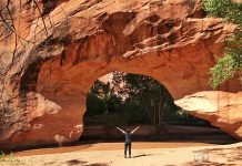
After a few twists and turns (and trying to avoid tourists) for 3/4mi, you’ll come to the Natural Bridge directly in front of you. Can’t miss it even though it’s not all that impressive. If you’ve seen any at Arches National Park, this is it’s lame baby cousin. It’s about 50ft high off the trail.
From there you can continue another 1/4 mi to a dry waterfall which marks the end of the trail. We didn’t continue this trek as we were pretty unimpressed with what we had seen thus far and wanted to get away from the tourists, so we just headed back from there.
Another blog that took lots more and better pictures than I did is available here.


