


The Navajo loop trail is probably one of the most popular, best, fastest, and easiest ways to see and hike in Bryce National Park. Bryce is a pretty small park as far as national parks go. There’s really only one attraction, which is the canyon and then all of the view points and hikes are just different ways to experience the canyon.
The Navajo loop trail is a short trail from one of the rims to the bottom of the canyon and then back up again. So it’s a good way to hike into the canyon and see other vantage points without committing a lot of time to a longer more involved hike.
Overview:
- Distance: 1.3 mi loop
- Type: Loop
- Time: 30-90mins
- Elevation at trailhead: 8,000 feet
- Elevation Gain/Loss: -500ft
- Difficulty: Moderate
- Crowd Factor: Moderate-High
- Best Time: May-June, Sept-Nov
- Permits/Fees: No, Bryce Entry Fee: $35
- Water: No
Directions to the Trail Head
There’s only one entrance to Bryce Canyon, which is to follow route 63 into to the park. The Navajo Trail starts at Sunset point, which is the first (and thus one of the most popular) view points in the park. You can drive to Sunset Point yourself and take the trail from there, or you can catch the Bryce Shuttle, which stops at all of the view points throughout the park.
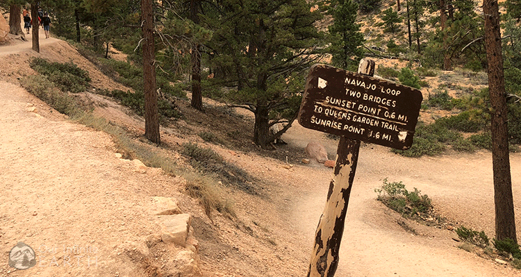
From the viewpoint at Sunset Point, there are clearly marked signs directing you to the entrance to the trail.
What To Expect Along The Trail
This trail is pretty straight forward and hard to miss. It starts descending immediately from Sunset Point. The very top portion of the trail is paved, but it soon turns to packed dirt. This isn’t a “hike” so much as it’s just the fastest way to get to the bottom of the canyon and back. The majority of the path is hard packed dirt and evenly flat for the entire trial.
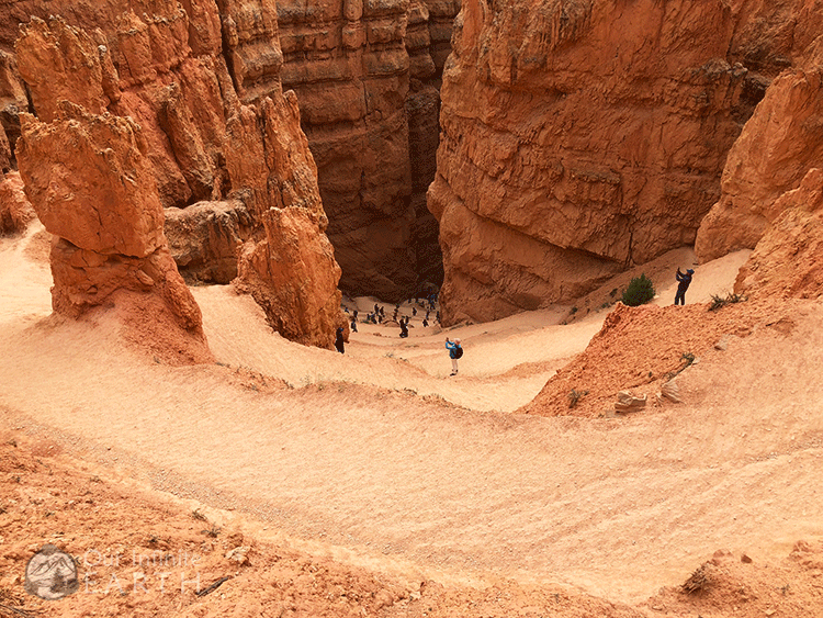
The trail is almost a perfect loop with each side up and down being very close distances to the bottom. The path on the left is .6mi whereas the path on the right is .7mi – not that I makes much different, but I would recommend going down on the right so that you have a shorter distance when coming back up.
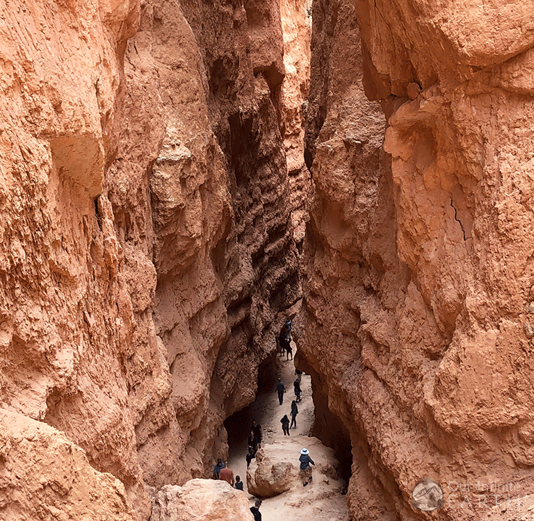
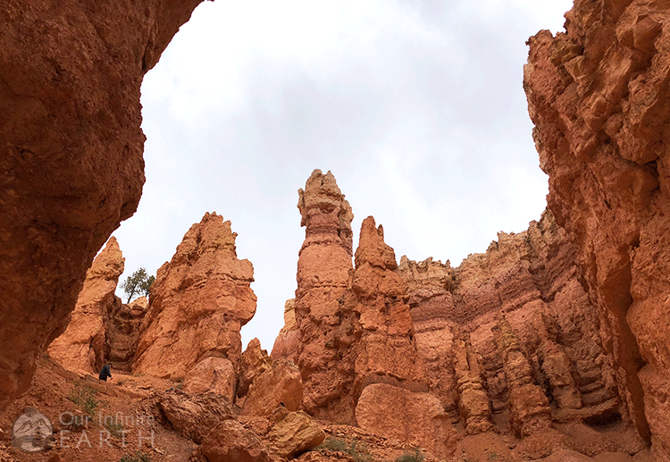
The decent starts with a series of switchbacks that are steep and quickly drop you a good distance into the canyon. At the bottom, the trail narrows as you walk through the tall canyon walls. You’ll start to be accompanied by a few trees. You’ll decent a little further to a flat section that’s likely the path that water runoff takes when it rains. If you’ve taken the path to the right to decend, this rock formations in this area are “Wall Street”.
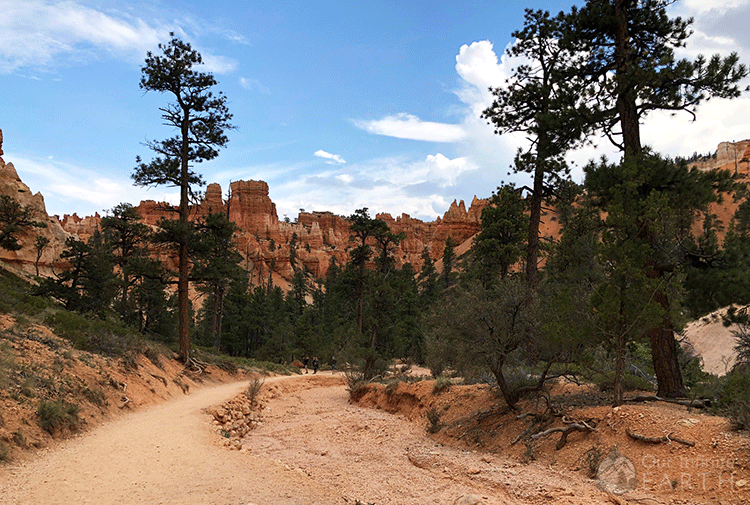
Continuing along this flat section, there are now lots more trees. You’ll soon intersect with the Queens Garden Trail, which is a longer alternative route back up to Sunset point. Continuing along the Navajo Trail, it will accent the same way that it descended, just with a slight change in scenery.
There’s very little shade on this trail – it’s almost completely in the sun with the only relief between the short more narrow section of the canyon after the switchbacks. It can get very hot here in the desert in summer, so drink lots of water and wear lots of sunscreen!
