


Svartifoss is like no other waterfall I’ve ever seen. This is entirely due to the black basalt rock formations that surround it, creating a stunning visual motif. When hiking along the ridgeline approaching Svartifoss (Black Falls), you’d half expect to see Frodo and Sam from The Lord of The Rings walking along side you.
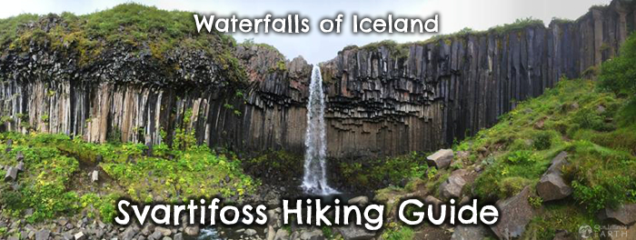
It’s like a troll or other giant other-worldly being grabbed a fist full of Earth from this beautiful green grass lands full of wild flowers and carved out a black-rock rimmed 40ft waterfall, all of which sits on top of a mountain bordering a glacier. What more could you possibly ask for?!
There are several other waterfalls along the hike that are not to be missed along with many incredible views and options for continuing on to other popular vistas.
The only negative is the crowds, but it’s Iceland, so that’s unavoidable. However, given that this waterfall requires a short hike to get there and is more towards the eastern end of the Island, it’s a little less crowded than some of the other popular falls.
Overview
- Distance: 2mi/ 1.5km round trip
- Type: Out & Back
- Elevation at Trailhead: 0ft
- Elevation gain: 450ft/ 140meters
- Difficulty: Easy
- Crowd Factor: Moderate-Heavy
- Best Time: May-Sept
- Permits/Fees: No
- Time: 1-1.5 hours round trip
- Water: Yes, needs to be filtered
Directions to Svartifoss Trailhead
Svartifoss is located within the Skaftafell area of Vatnajökull National Park, about 20mins west of Hof.
Park at at the Skaftafell Visitor’s Center, which is at the end of Route 998 (off Route 1).
Fun fact:: Skaftafell was a manor farm and a local assembly site during the Middle Ages until it was acquired by the Church. The original farmhouse stood at Gömlutún (Old Hayfields), where ruins can still be seen today.
Here you can get information on the available hikes and trails in the area as there are a few different ways to see Svartifoss depending on how much you want to hike. You can do it as an out and back hike, or create a loop with some of the other available attractions.
Eco-Friendly Tip: The visitor’s center offers paper maps with trail information for a fee. Take a photo of the giant map outside on the board with your phone instead which contains all the same information. Save paper and save money!
Hiking The Trail To Svartifoss
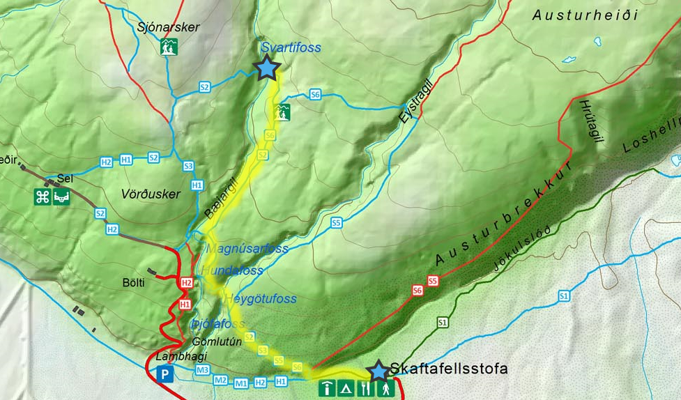
From the visitor’s center, follow trail signs for S2, S3, S5, S6 – which are clearly marked. You’ll walk west for about 800 ft/ 250 meters through a campsite. The trail will then veer to the right and uphill (continue to follow for S2, S3, S5, S6). The path here is paved and it doesn’t feel like the trail really begins until you start up the hill, which is the steepest part of this trail.
After about .25mi/600 meters, you’ll pass Þjófafoss (another waterfall) on your left. Shortly there after trail S5 will branch off to the right, but continue straight/left following S2, S3, S6.
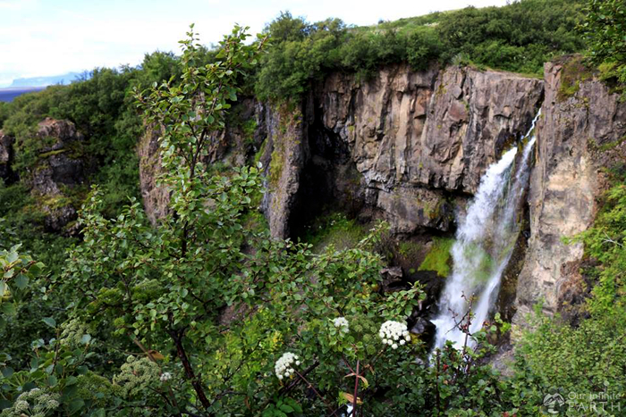
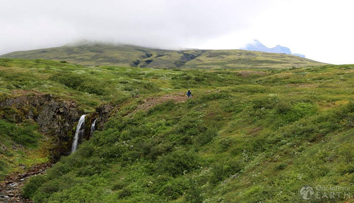
You’ll continue to climb for another 1500ft/400meters passing views of three other waterfalls (in order: Heygotufoss, Hundafoss, Magnusarfoss). Don’t rush through these waterfalls as they are each beautiful and worth stopping. The trail will separate again, follow signs for S2, S6 to the right.
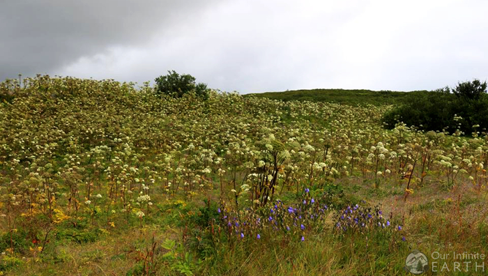
The next .25mi/600 meters of the trail is along the top of the ridgeline and is fairly flat. There are meadows with wild grasses and flowers (depending on the time of year). Make sure to take a moment to turn backwards and look out towards the ocean for a fantastic view of the land below.
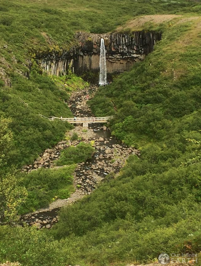
You’ll then reach a view point at the top of the ridge where you can clearly see Svartifoss ahead of you. The path separates again here, follow S2 to the left, down into the ravine and to the footbridge to get up close and personal with Svartifoss.
To get back, you can follow the same path back, or I would recommend taking in another view:
- Follow S6 to Eystragil and get an incredible view from above one of the fingers of the Vatnajökull glacier (from which the park gets its name), then follow S5 back (this is what we did)
- Follow S2 to S3 to the view point at Sjónarnípa and then follow S3 back down.