This is a short but difficult hike to two beautiful lakes in the Sierra Mountains in Inyo National Forest. Yost and Fern lakes sit on opposite sides of a large rocky peak. This hike is more often done as a day hike, but can easily be done as a weekend backpacking trip as well.
I personally preferred Fern Lake over Yost for the more dramatic views and shorter hike, but both have their pros and cons.
Trail Overview
- Distance: 3 – 6.5mi round trip
- Type: Out & Back
- Time: 3-6 hours
- Elevation at trailhead: 7,200 feet
- Elevation Gain/Loss: 1,700-2,600 ft
- Difficulty: Hard-Strenuous
- Crowd Factor: Low-Moderate
- Best Time: May-Oct
- Permits/Fees: Overnight Permits Required
- Water: Yes, needs to be filtered
Highlights
|
Lowlights
|
Directions to the Trailhead
This trail is located in the Eastern Sierras in the Inyo National Forest, in the June Lake region.
There’s a small sign marking the trailhead on the road. Drive over the small bridge into an ample parking lot. There’s a porta-potty and also a bear box here if needed.
Backpacking Permits
This isn’t a super popular trail for backpacking due to the steep terrain, so permits aren’t very competitive. Backpacking permits are required for camping overnight in the Inyo National Forest and can be gotten here.
Only 8 permits are available per night, with 5 being available for pre-registration online. The closest location for picking up your permit is Mammoth Lakes Welcome Center, which is about 30mins south.
Rules for permits:
- No campfires
- Bear containers are required for storage of food and trash
- Must camp 100ft away from the lake
What To Expect Along The Trail
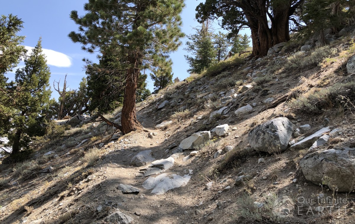
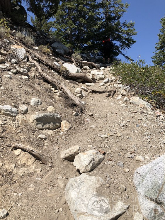
Get ready to go up, up, up! This is a relentless climb up the side of the mountain. Don’t let the short distance fool you – this much elevation gain at this altitude is sure to get you breathing heavy.
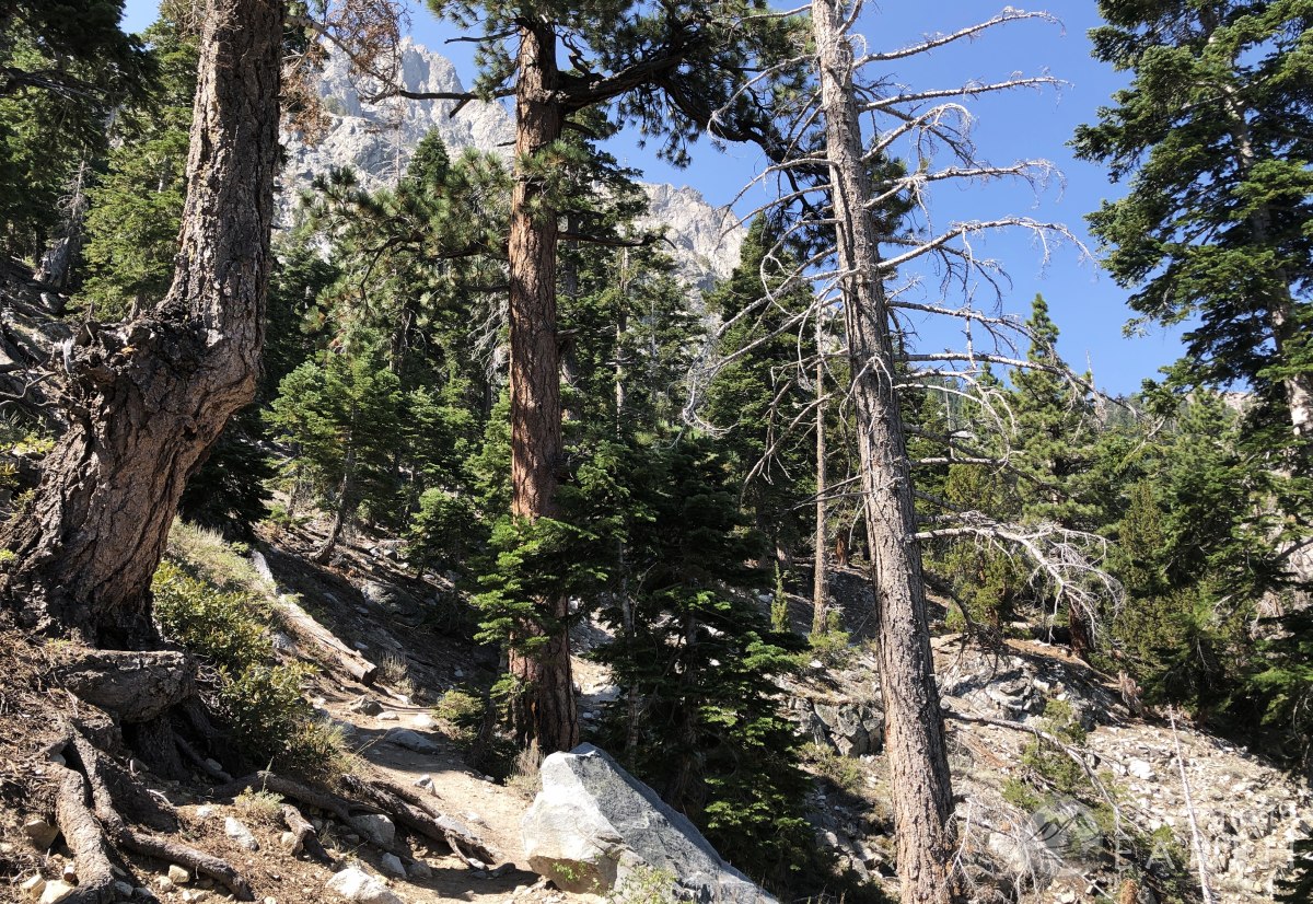
The first maybe 20ft of the trail is deceivingly flat, but this quickly ends as you start your continuous climb over the next few miles. The first mile of the trail climbs roughly 1,000ft in elevation.
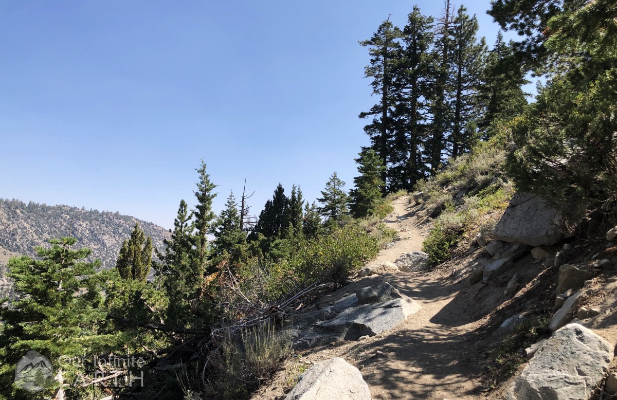
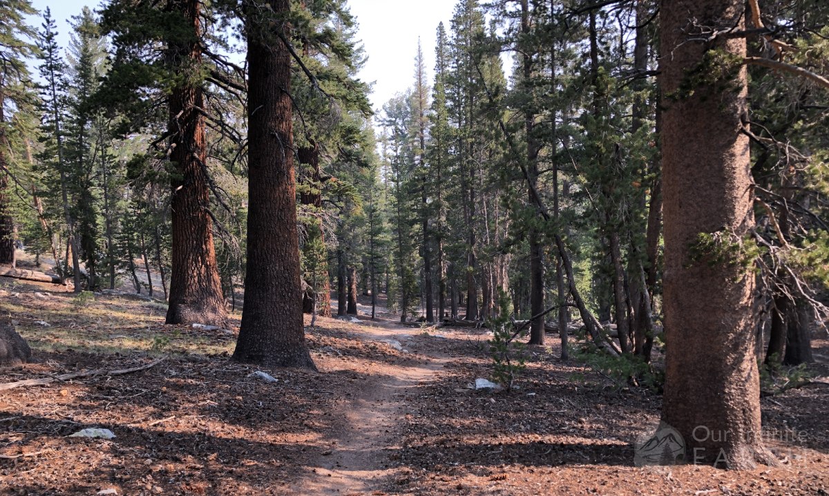
The good news is that even though you’re going up the whole time, the trail isn’t just a boring series of switchbacks. There are only 2 switchbacks to count on the entire trail. The majority of the terrain is a packed dirt trail with some rocks and roots that will occasionally force you more into climbing stairs that walking a trail. Also, the vast majority of both trails are shaded for most of the hike with only a few stretches of maybe 200ft of sun.
You quickly get some nice views of the lakes down below/behind you which is a nice distraction from the difficulty of the trail.
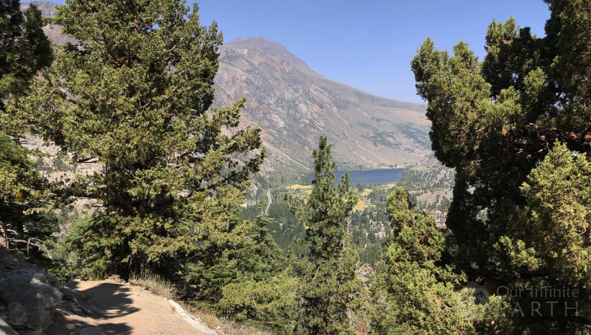
You’ll also see the impressive rock mountain tops looming above you for most of the trail, which is really beautiful and gives you something so strive for.
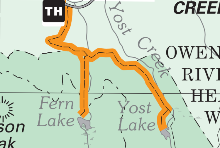
The trail continues along the ridge of the mountain for the first mile before splitting to Fern and Yost lakes where the trail then heads deeper into the mountains and forest. You can hear the the cars on the roads below as you’re hiking along the ridge, which was a bit of a disappointment.
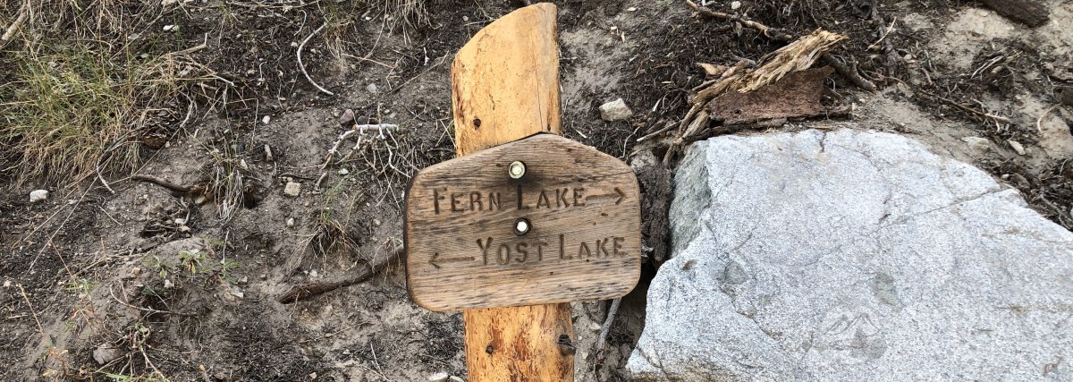
After about 1 mile, you’ll come to the junction of the trails for Yost Lake and Fern Lake. To the left will take you to Yost Lake, whereas the trail to the right will take you to Fern Lake. Both are clearly marked. Those wanting to see both lakes will usually go to Yost first and then on to Fern.
- Elevation at trailhead: 7,200 feet
- Elevation of Trail Split/ “waterfall”: 8,200 feet
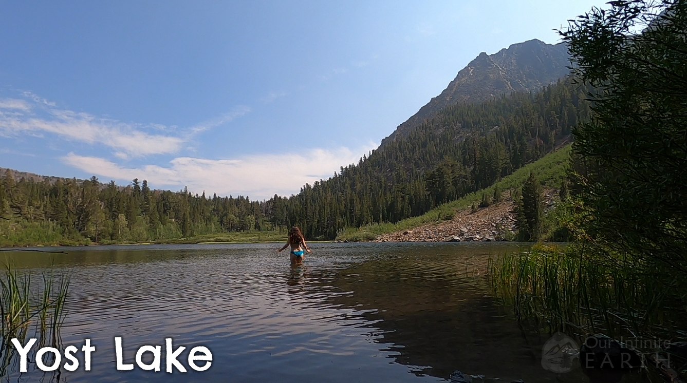
- Elevation of Yost Lake: 9,100 feet
- Elevation of Fern Lake: 8,900 feet
Note that several other blogs that I read before going stressed the importance of bug spray for both of these lakes. We were luckily that the bugs weren’t much of a problem for us at all (and they usually LOVE me) at either lake, but there were a few at Yost.
To Yost Lake
Your journey to Yost Lake will take you another 1.5 miles past the split of the trail.
Right after the split, you’ll have to deal with a rather hair-raising creek crossing.
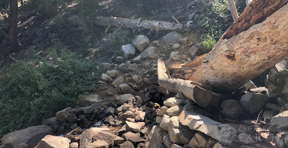
We met a few people on the trail who were asking about “the waterfall”, and during seasons when this creek is strongly flowing, there probably would be a pretty substantial waterfall upstream from this crossing.
The trail after the crossing continues at roughly the same elevation gain as what you’ve done thus far. This continues for the next .75mi along the ridge of the mountain and then flattens out as it turns inland.
The wilderness boundary sign roughly marks your halfway point on this trail. The flat terrain only lasts a short while before the trail starts to climb again, but at a much lesser rate.
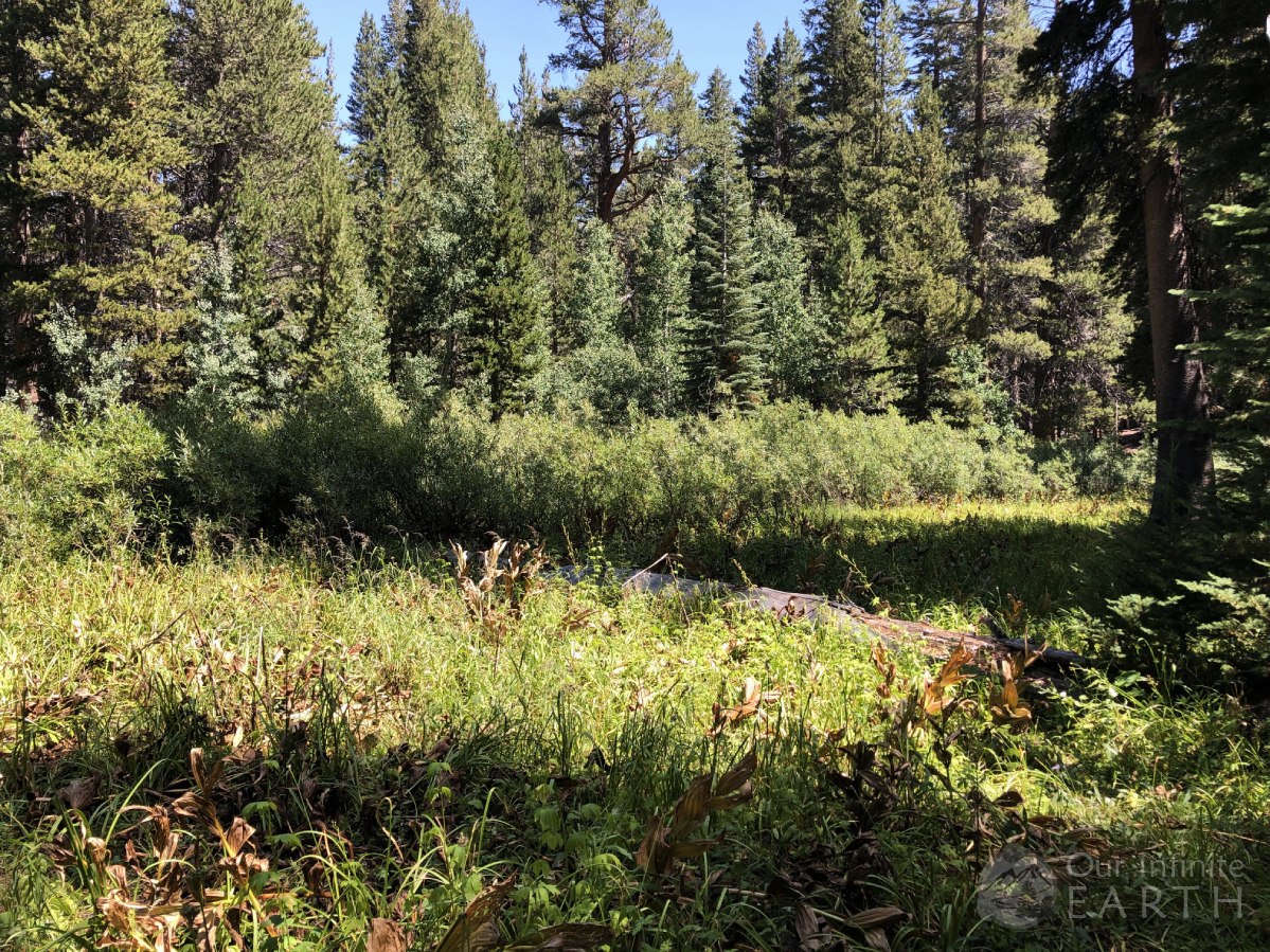
The next .75mi will pass through a forest of aspens and sequoias.
Shortly before the lake the trail will split again with an option of going to Yost Meadows to your left or continuing on to the Lake to your right/straight. You’ll just have one more final push up a slight include just as you reach the lake which sits at 9,100ft.
Pros & Cons of Yost Lake
- Little direct access to the lake. The lake is surrounded by trees and brush and there are only a few paths where you can access the lake.
- Quieter and more secluded
- Less trafficked
- Less windy
- Seemed to be a bit warmer than Fern if you wanted to take a swim. I think the lake is pretty shallow all the way across. I walked out a good distance into the lake until the bottom turned muddy and “lake weed” started to rub against my legs.
Camping at Yost Lake
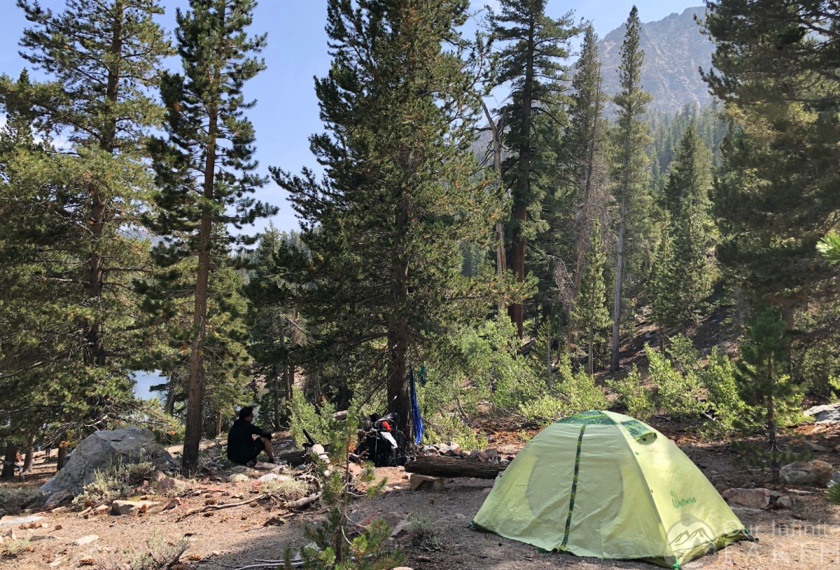
There’s really only one good place to camp at this lake, which is up the hill to the right of the trail when you first get to the lake (northwest side of the lake). The rest of the area around the lake is difficult to access and dense with trees and brush. Up this hill is an area of flat land and we also found a firepit and log for sitting that some other campers had build and left behind. We were the only people camping at this lake.
To Fern Lake
Continuing on from the trail split, you have another .75mi to go before reaching the lake. The trail to Fern Lake gets VERY STEEP for the next .25mi – you’ll climb roughly another 800ft over the next .5mi. This is probably the toughest part of the trail.
Then the trail evens out a bit as it turns inland and goes through the forest. The wilderness bounty is your marker that the worst is behind you and you only have around .5mi before reaching the lake. While the trail evens out significantly, you are still continuing to go up, just as a much lesser rate. You’ll pass through a forest of aspen trees as you near the looming rock mountains towering above you.
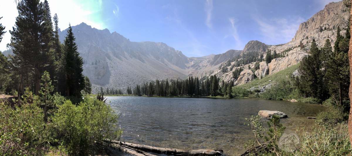
The last 100-200ft is another steep push upwards before arriving at the lake. Fern Lake is at an elevation of 8,900ft, which is a little surprising when compared to Yost since higher elevations are usually less hospitable, but with these lakes it’s the opposite and you’d expect Fern to be the higher elevation of the two lakes based on the terrain.
Pros & Cons of Fern Lake
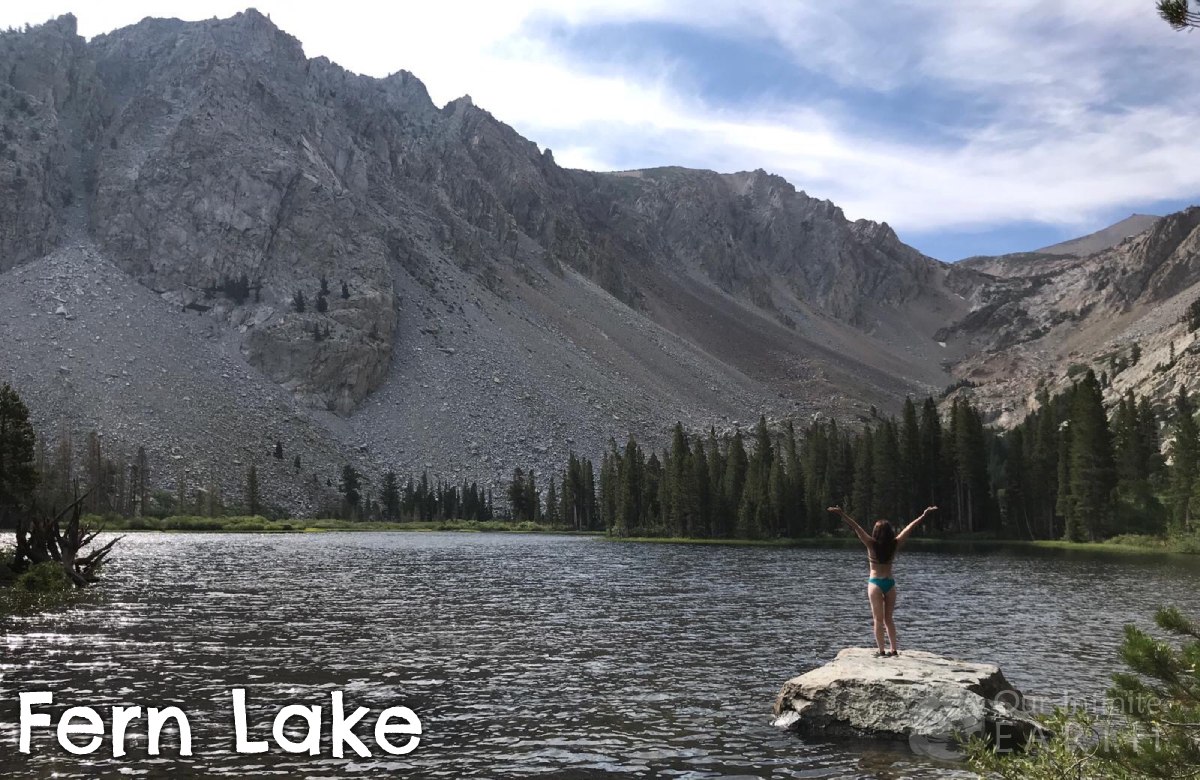
- Bigger payoff than Yost does as the views are absolutely astounding
- More people and more trafficked, for both day hikers and backpackers
- VERY windy (at least during our stay)
- Easy access to the lake and a “beach” on the northwest side of the lake
- Full of rainbow trout! Note that you’re supposed to have a fishing licence if you’re going to try to catch any of them.
Camping at Fern Lake
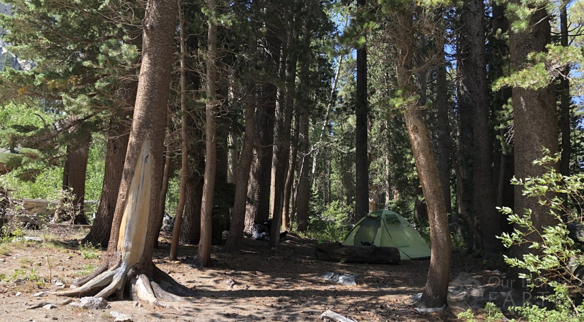
There are several good camping spots around the lake. There’s a small hill to the north side of the lake (left of the trail as you just reach the lake) which has several good spots. This area is very flat and others have built campfire circles here (to protect your stove from the wind!). There’s also a good spot on the northeast side of the lake in a flat wooded clearing, and also a spot (where we camped) on the westside of the lake in the forest.
For both lakes, look for these plants along the trail before you get to the lake, it means you’re almost there and you’ve got less than 10mins to go before reaching the lake!