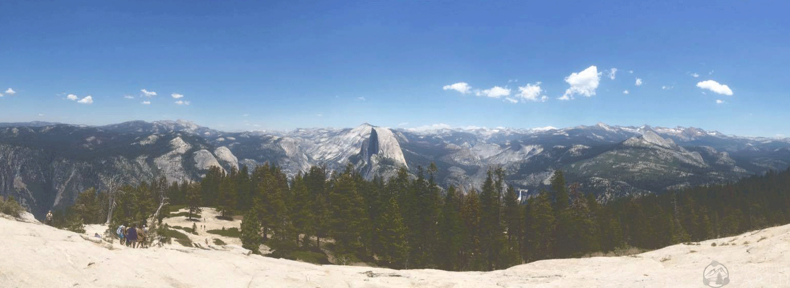
Taft Point and Sentinel Dome are two prominent landmarks along the south rim which boarders Glacier Point Road. You can visit each point or connect both into a loop trail for a great day hike. It’s a picturesque with views that include a “reverse tunnel view”, Half Dome, and Upper and Lower Yosemite Falls . The trail is mostly flat hike with lots of views overlooking Yosemite Valley.
Overview
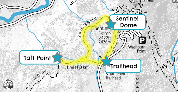
- Distance: 5.2 miles round trip
- Type: Loop
- Time: 3.5-4 hours round trip
- Elevation at Trailhead: 7,750ft /2,362m
- Elevation Gain: 1140ft/ 347 meters
- Difficulty: Easy/Moderate
- Crowd Factor: Light-Moderate
- Permits/Fees: No, Yosemite Park Entry Fee: $35
- Water: No
Directions to the Trail Head
From the South entrance: Go approximately 17 miles to Glacier Point Road.
From the valley Follow 41 for 9 miles to Glacier Point Road on the left.
Follow Glacier Point Road, for approximately 13 miles and the lot will be on the left.
The trailhead for both Taft Point and Sentinel Dome are located at the Sentinel Dome parking lot, so it’s usually pretty full and you may need to park on the side of the road.
What To Expect Along The Trail
First choose which landmark you want to see first. Both Taft Point and Sentinel Dome have a trail leading to it from the parking lot and as such these landmarks will be more crowded than the portion of the Pohono Trail you’ll take that connects the two. The Pohono Trail at Sentinel Dome gets steel and accounts for pretty much all of the elevation gain on this hike. So if you prefer to go down, start with Sentinel Dome; if you prefer to go up, start with Taft Point.
For our purposes, we started with Taft Point, saving the harder part and rewarding “we made it to the top” moment for the end of the hike. This also allows for better views of Upper and Lower Yosemite Falls than the reverse. All of the trails here are very well marked and very easy to follow regardless of which way you go.
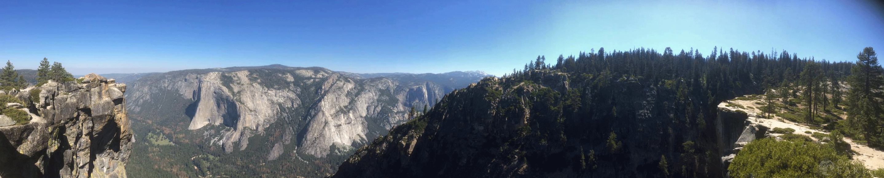
The trail from the parking lot to Taft Point is a little over a mile. It’s slightly down hill and completely flat with packed dirt. Trees cover the trail to protect you from the sun. Once you get to the point, the trees disappear as you approach a rock ledge with massively steep 4,000ft drop off, most of which is not boarded by a guardrail. The view is breath taking and you can see for miles.
You’ll be stepping out onto The Fissures, which according to Yosemite Hikes, was created by “an epic battle between Mothra and Godzilla, during which Mothra slashed at his scaly foe but missed and raked his talons against the cliffside instead.” lol
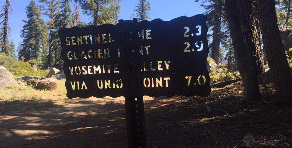
To then go to Sentinel Dome, you travel back up the same trail for a little while before it branches off to the left to the Pohono Trail. Signs are clearly marked and say “Sentinel Dome”, so there’s no confusion. This stretch was my favorite part of the hike. You are walking along the ridgeline of Glacier Point with Yosemite Valley down below you to your left.
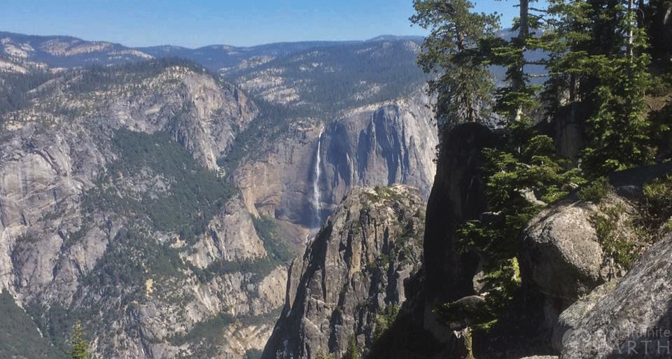
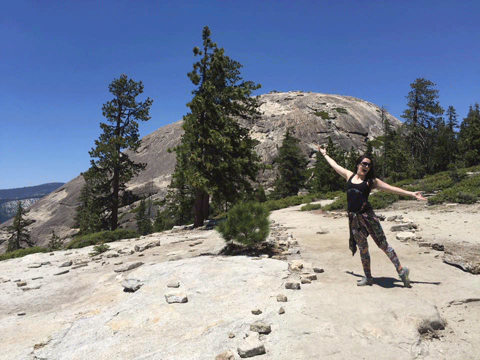
Pretty much the entire hike is a nothing but beautiful views. As you’re walking towards a view of Yosemite Falls across the valley, it will consistently be in front/ below you on the trail. The trail is flat, easy, very slightly uphill, and covered by trees. The last portion as you circle around and climb the backside of the dome is steep. To get to the top of the dome, you have to walk straight up the side of the rock and you’ll be rewarded with an amazing almost 360 view of the park.
The trail from Sentinel Dome to the parking lot is a little under a mile and is flat, packed dirt, and covered by trees. Also, very clearly marked and easy to find. It’s not as pretty as the Taft Point trail, as you don’t have the views over the valley, but it’s a good way to create a loop out of the two other trails.