


Boynton Canyon trail in Sedona is a popular box canyon that doesn’t disappoint! It’s one of the most scenic box canyons that make Arizona Red Rock Country so famous. It’s an easy trail that’s also shaded (big plus in the desert!) with very impressive cliff faces and a seasonal waterfall at it’s end.
Trail Overview
- Distance: 6 mi round trip
- Type: Out & Back
- Time: 2.5-4 hours
- Elevation at trailhead: 4,542 feet
- Elevation Change: 860 ft
- Difficulty: Easy-Moderate
- Crowd Factor: Moderate – High (during beginning)
- Best Time: May-June, Sept-Oct
- Permits/Fees: No
- Water: No
Highlights
|
Lowlights
|
The trailhead
The Boynton Canyon trailhead starts just off of Boynton Canyon Road. The paved parking lot is a medium sized lot which holds 25 cars. But like all the other popular hikes in Sedona, the parking lot fills up fast – by 7:30am, it was already full! This trail is also how you get to the insta-famous Subway Cave, which adds to it’s popularity and the crowds!
Overflow parking is allowed on the side of Boynton Canyon Road – but this also will fill up fast – by 8am, the closest parking was already .25mi away.
To park in the lot (if you’re lucky to get a spot), you need to have a Red Rock Canyon Parking Pass. You can purchase the pass in the lot from a vending machine at the entrance (which is also next to the pit toilettes). The parking pass is $5/day or $15/week (which is a good option if you’re doing other hikes in the area as most require a parking pass).
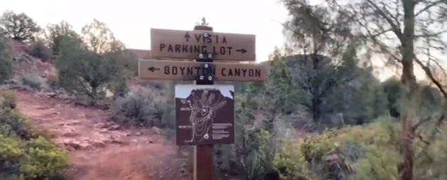
The trail starts directly across from the toilettes and parking pass vending machine.
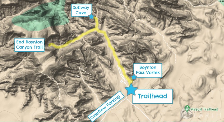
Trail map
What to expect along the trail
The trail is flat, easy, and easy to follow – there are a few twists and turns early on, but there are lots of signs to point you in the right direction to stay on the trail.
Getting to the Boynton Canyon Vortex
After .3 miles you’ll reach a junction with Boynton Vista Trail, which is a side trail that goes to the Vortex and also provides some views of the Enchantment Resort.
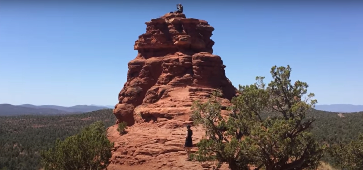
This side trip to the Boynton Canyon Vista is .4 miles round trip. The last portion of this before you reach a big red bell shaped rock is moderate to strenuous as you’re moving uphill for post of it.
Continuing to Boynton Canyon Overlook
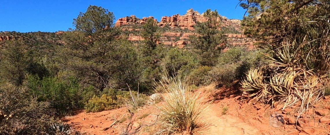
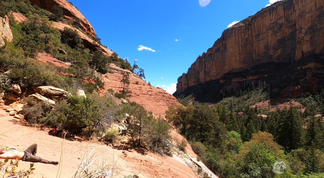
Continuing past the junction with the vortex, this part of the trail is pretty exposed and there’s not a lot of shade. For the next mile you’re hiking alongside the Enchantment Resort.
While there are some impressive sandstone red rock cliffs on your rights, the resort diminishes the experience of “getting away to nature”. There are a few ups and downs, but nothing that strenuous.
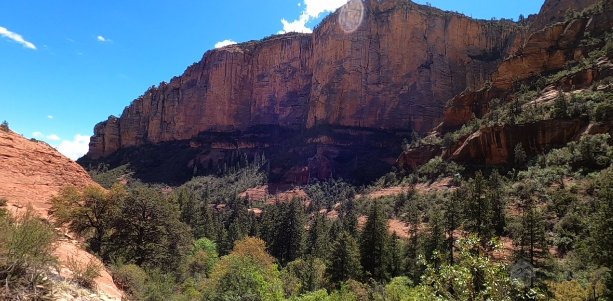
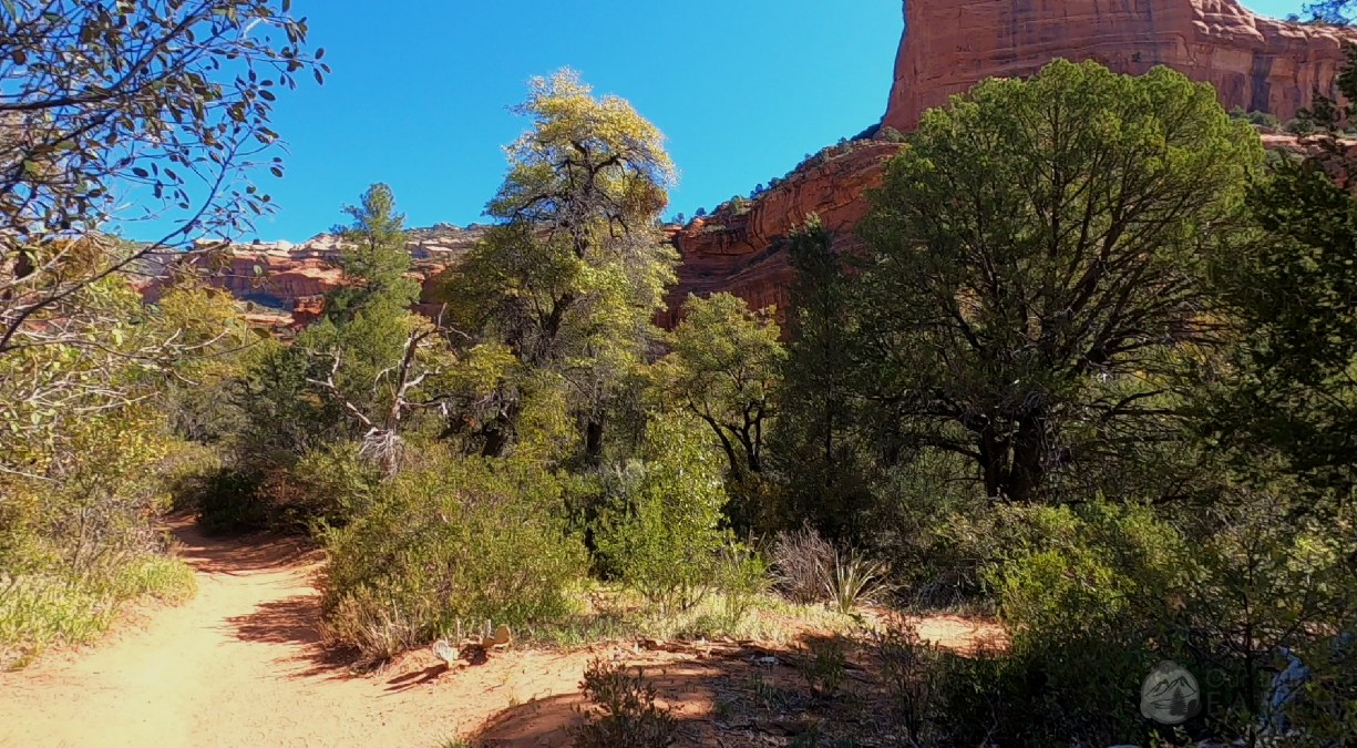
Once you pass the resort, the trail continues through a few stubby short brushy trees. This brushes soon give way to some larger trees and thus, also a little shade. As you continue on the trail into the canyon, the red rock sand stone walls continue to tower from both sides and slowly narrow.
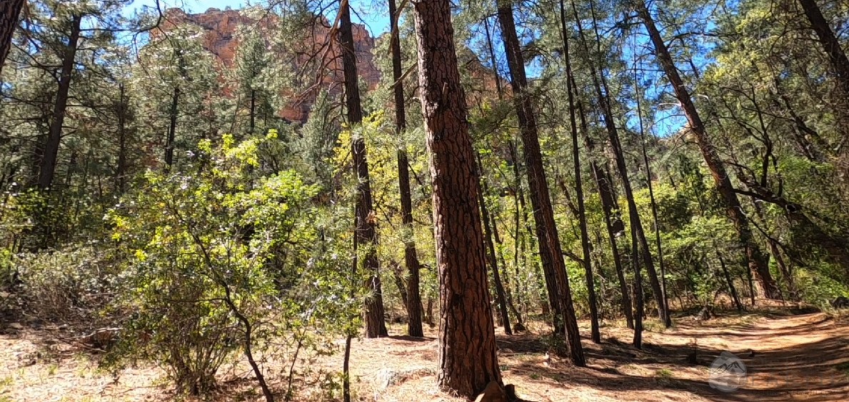
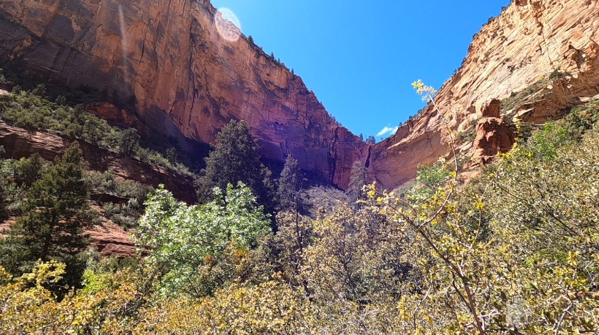
The further you go, the more shade and trees there are. After about 2miles there’s a lot less crowds on the trail (as most have branched off to find the subway cave) and you’ll find yourself surrounded by pine trees. From here on, the trail climbs slowly uphill as you approach the overlook.

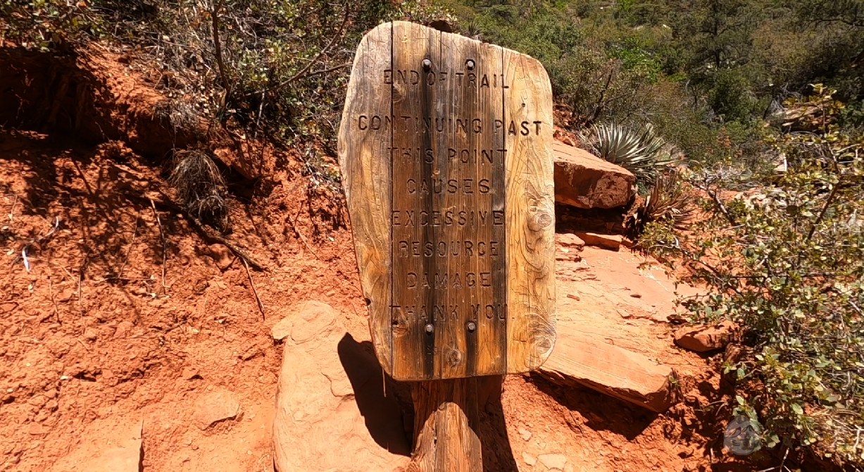
The last half mile gets steeper still as the trail maneuvers around some larger rocks and boulders. The last section of the trail has some “steps” onto the large rocks just before you reach the overlook. There will be a sign that says you’ve reached the end of the trail.
At the end, the overlook is a large slightly slopped rock with lots of space to sit and take in the view.
There’s what looks like a dry/seasonal waterfall at the very end of the canyon to the right. You can continue to explore this area and take in the views.
Hi Sarah,
When you reach the Boynton Canyon Vista Trail after .3 miles from the trailhead, you say it is .2 miles to the vortex. If I am standing in the saddle, what is the difference in elevation from the beginning of the Vista Trail to the saddle? In other words, what is the change in elevation for that last .2 miles?
Thank you.
When approaching the vortex, there is an increase in elevation. It’s a pretty steep climb at the end, but I’m not sure about the exact elevation change. Maybe 400ft?